Staffordshire
Latest Information
Consultation on revised proposals
We may consult on revisions to our original proposals.
Dates: 30 Jan 2024 - 12 Mar 2024
Previous stages
-
We consult with local people and organisations to help us refine our proposals.
Dates: 7 Aug 2023 - 16 Oct 2023
-
We ask local people and organisations to tell us about their communities.
Dates: 10 Jan 2023 - 20 Mar 2023
-
We decide how many councillors an authority should have.
Dates: 10 Jan 2023 - 20 Mar 2023
We review the electoral and boundary arrangements of councils to make sure they are fair. Our reviews include at least two rounds of public consultation before we make recommendations for change.
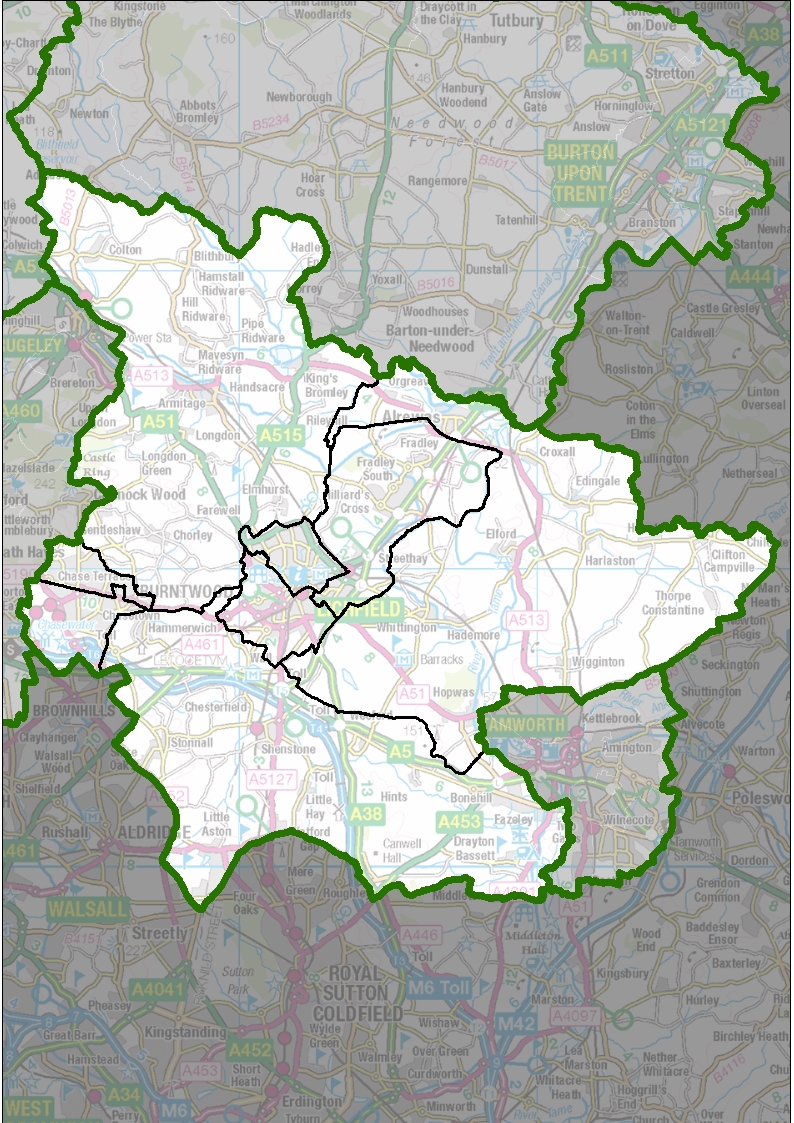
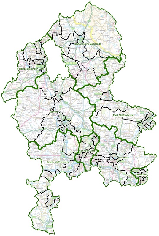
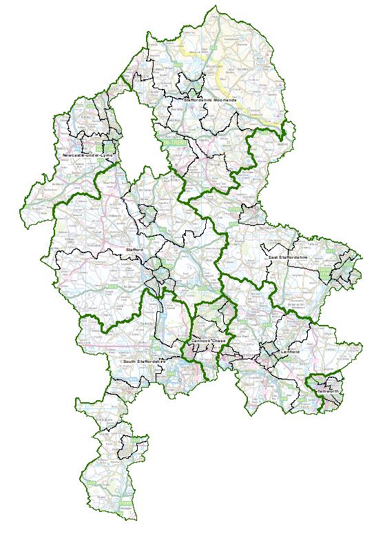
We are carrying out an electoral review of Staffordshire because it has been a long time since the last review.
| 13 December 2022 | We decide how many councillors there should be |
| 10 January 2023 - 20 March 2023 | We carry out an initial public consultation on communities |
| 8 August 2023 - 16 October 2023 | We carry out a public consultation on our proposals |
| 30 January 2024 - 12 March 2024 | We carry out a limited further consultation on our proposals for Lichfield district |
| 14 May 2024 | We publish our recommendations |
| TBC | We ask Parliament to approve our recommendations |
| May 2025 | New arrangements apply to local elections |
Visit our 'How reviews work' pages for more information on the review process.
Register for Updates
Latest Information
Consultation on revised proposals
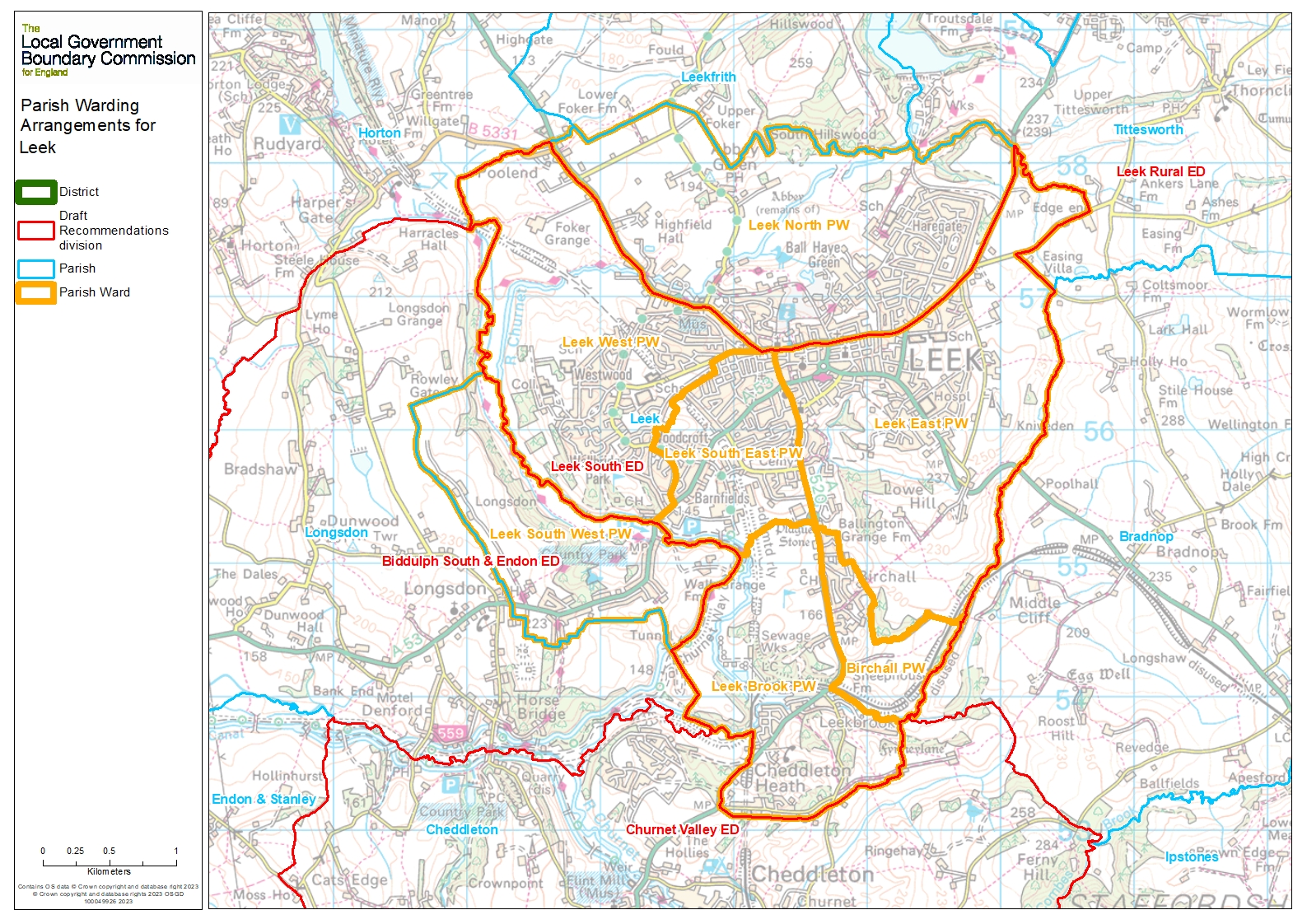
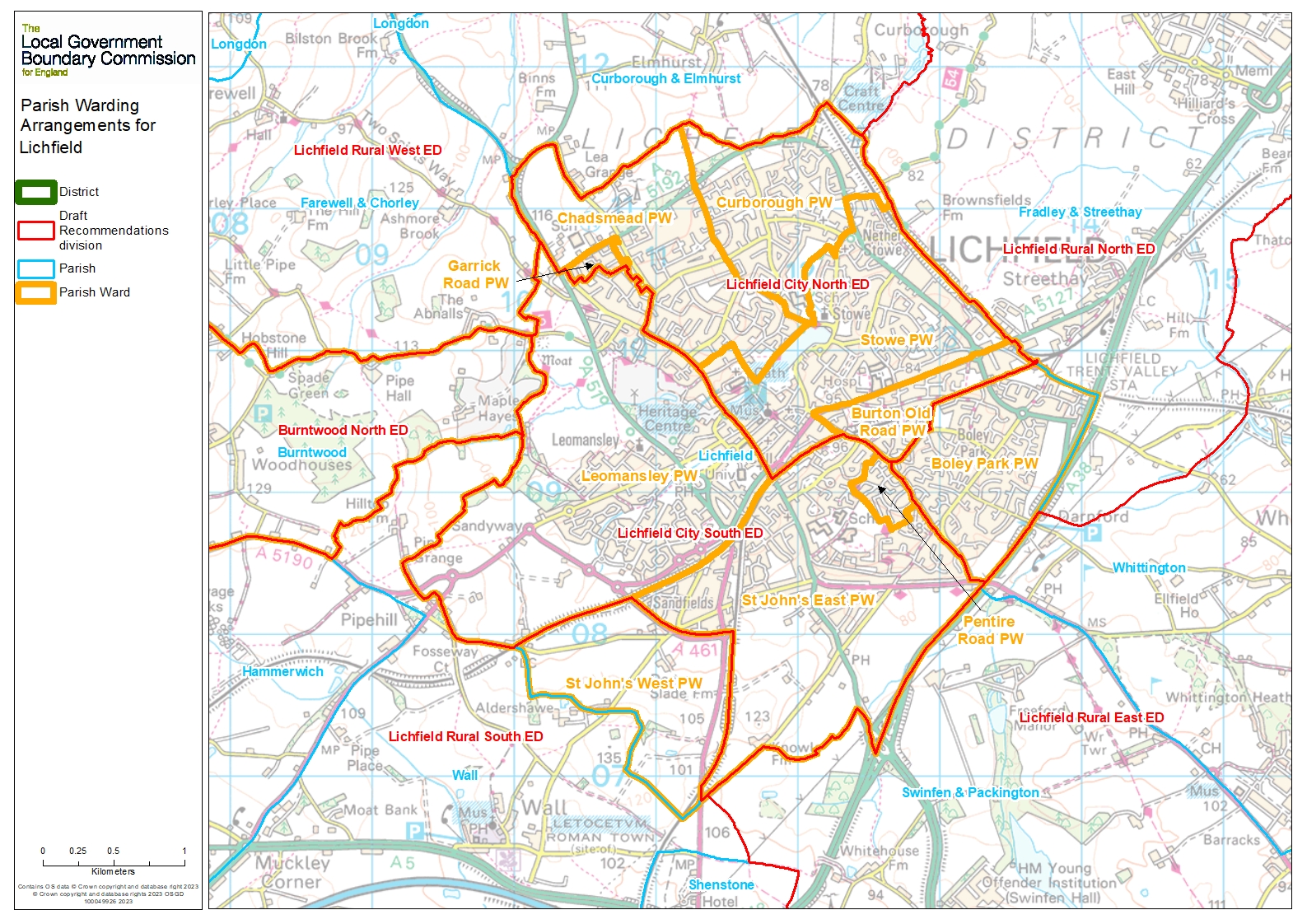
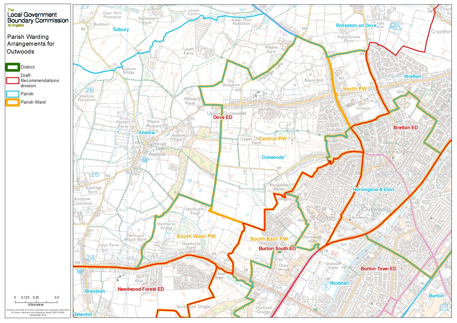
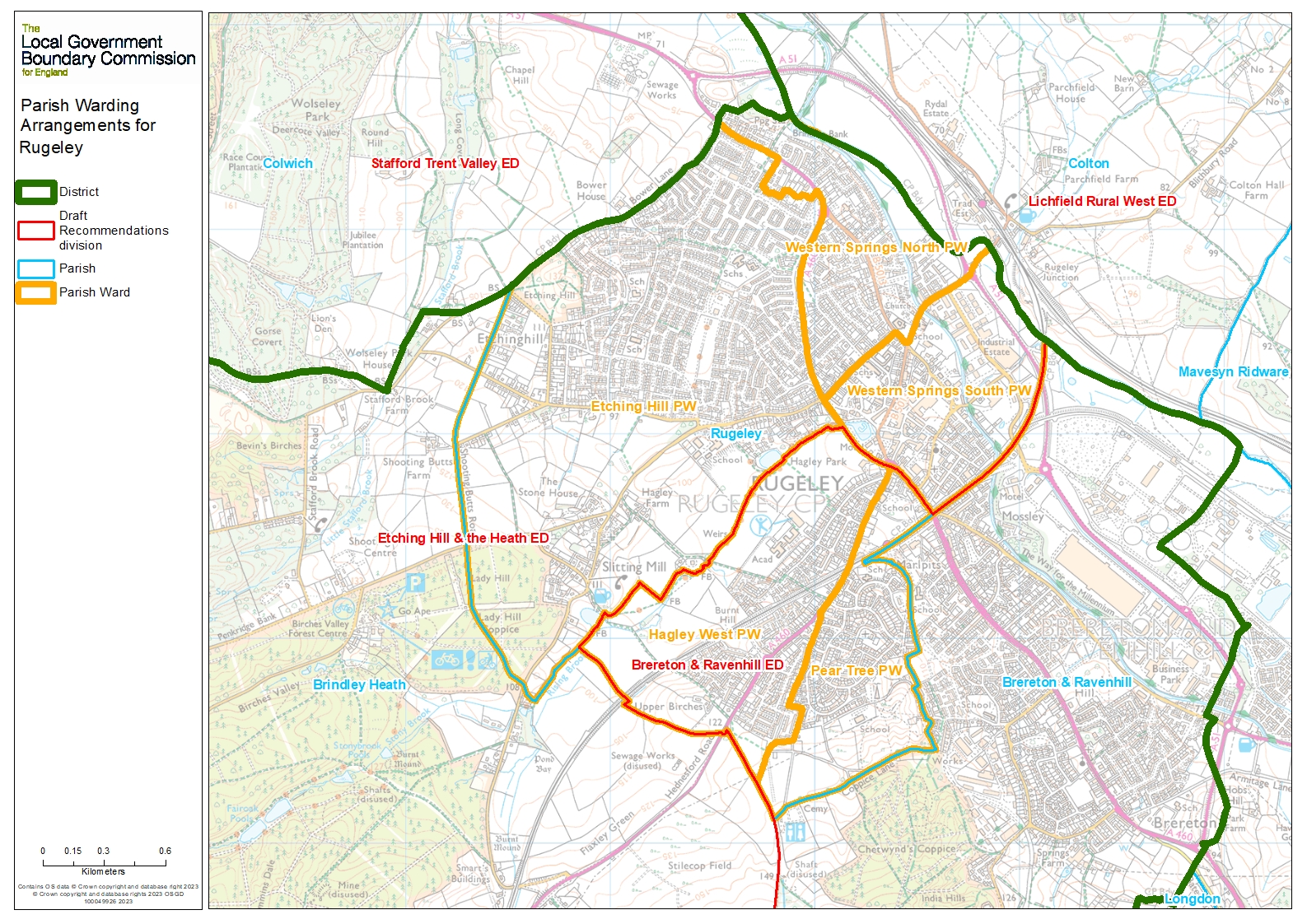
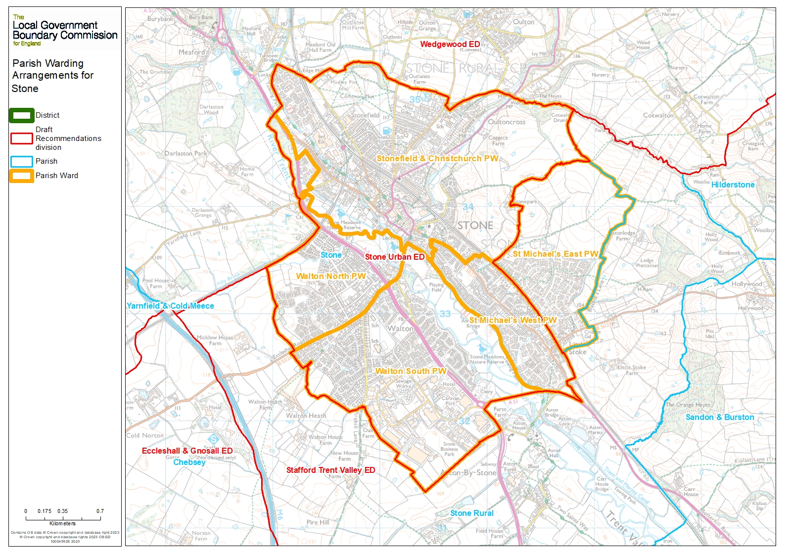
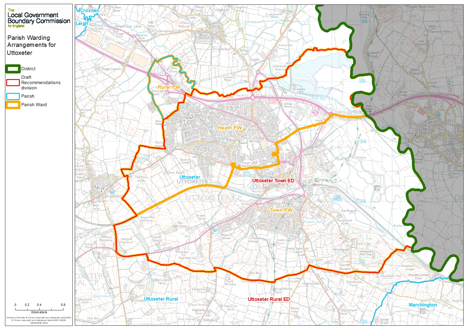
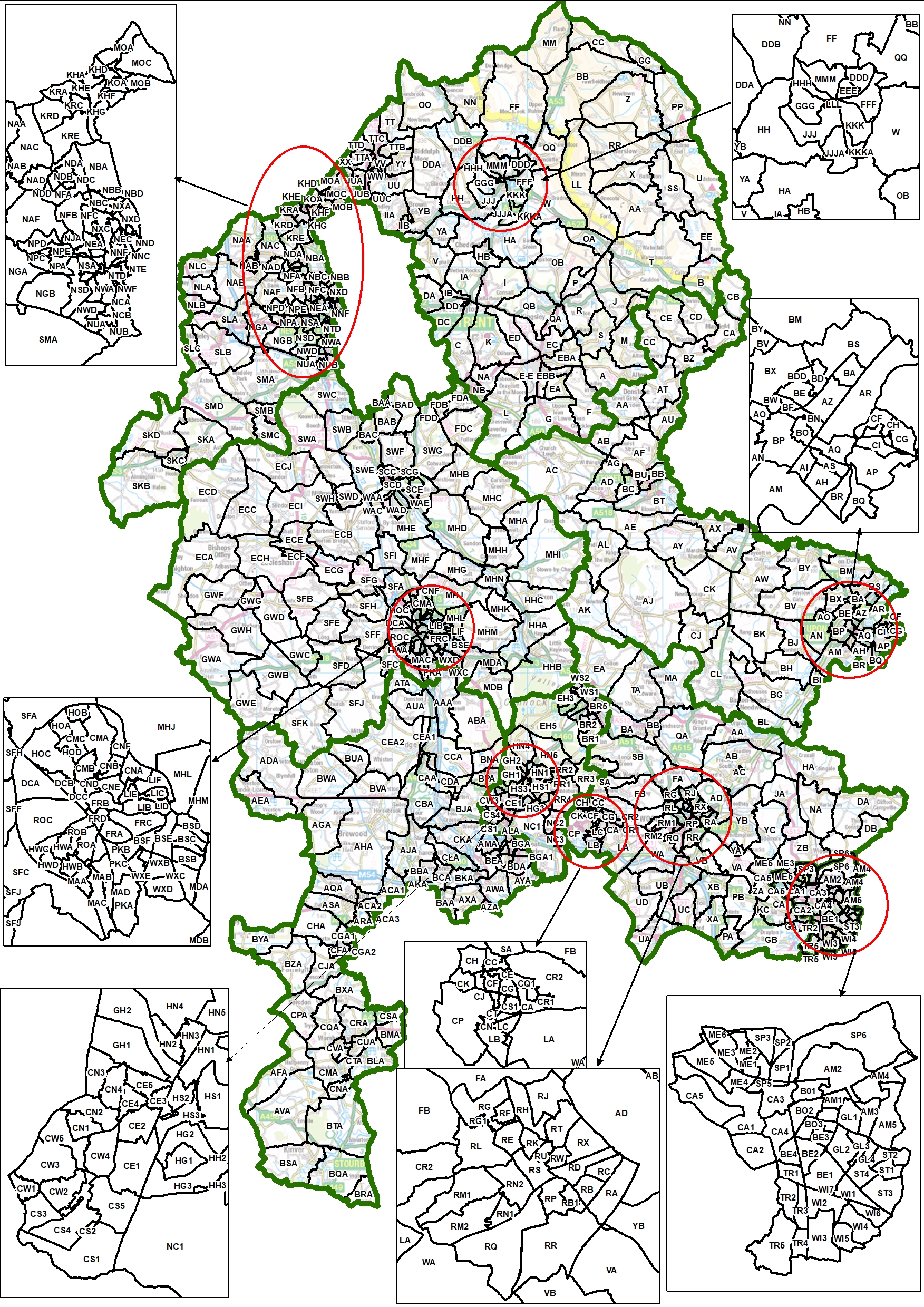
We have proposed a new pattern of divisions. We want to hear the views of local people and organisations to help us produce our recommendations for change in Lichfield.
Previous stages
Consultation on proposals
We have proposed a new pattern of divisions. We want to hear the views of local people and organisations to help us produce our recommendations for change.
Initial consultation
We ask local people and organisations to tell us about their communities.
Councillor numbers
Decision on the number of councillors
We have decided that Staffordshire County Council should have 62 councillors.
Previous Reviews
Previous reviews are held on the UK Government Web Archive